Multi-day tour: Mount Jocherer
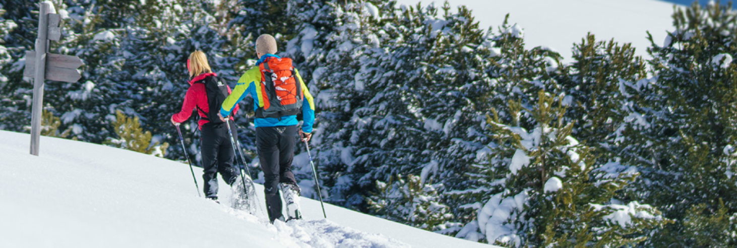
Great circular hike for one, two, or three days. Perfect in winter with snowshoes!
Let's start at the Obersttränke car park. Then, follow the alpine road (caution: in winter, it's a toboggan run with oncoming traffic) to the summer car park in Kaseregg. There, a weather cross will show you the right way: keep right, towards Latzfonser Kreuz 15. Sounds like an agent code, but it's just a hiking trail. Briefly through the forest and then across wide alpine meadows, always nicely along the fence. Always stay on the wide ridge – we don't want to get lost and suddenly end up on the belly of a sleeping cow, becoming gossip among the alpine animals! If all goes well, you'll reach the Kesselbild (2,242 m).
Continue along the ridge for a short bit to the highest point, the Jochererberg (2,394 m), which deserves a different name as it's definitely not a "yoke" (Joch): the magnificent panoramic view – you can admire the postcard motifs live – will reward any shortness of breath. From the wide summit plateau (a wonderful picnic spot if it weren't so windy), head southwest, keeping left of the stone fence, continue along the ridge and descend to the Latzfonser Alm. Shortly after a "signpost tree" with a bench (now, this is a good spot for a picnic break), keep slightly left across wide areas to a weather cross with a mountain pine belt (stylish!). To its left, along the fence, descend to the Gfohler Alm and south to – there we are! – Stöffl. Don't despair or ask others; they can't see it either, not until the very last few meters.
After a hearty stop (and accommodation option for anyone who can no longer stand on two legs), go back a few meters and turn right towards the east (signposted Kaseregg – Latzfons 0) across a narrow gully and in the same direction across wide meadows to the Steiner Almen. After the last alpine buildings, gently ascend in a wide left curve to an elevation, and at a wayside cross at the beginning of a short mountain pine zone (looks like a youth club for trees), descend on an alpine path. Pass below an alpine building and descend through the forest into a small valley. Keep right to the Jocherer Kasalm and continue to the Kaseregg car park. From there, take the same path back to the starting point – a lap of honour for our brave feet, so to speak.
Tip:
Why not turn it into a 2- or 3-day trip! Especially in winter with snowshoes, you'll experience magical days! However, please pay attention to avalanche warnings and consider the reports! It's best to get information here.
Day 1: Head up to Stöffl, where you can reward yourself for your efforts.
Day 2: Summit assault on Jochererberg – after all, you have to have been to the very top to be able to talk about it. And then comfortably back to the starting point.
Day 3 (for the very enduring): Snowshoe hike from Stöffl to Totenkirchl and back via Moar in Ums and Prackfiederjöchl.
Important Note for anyone who trusts their sense of direction a bit too much: In poor visibility, it gets tricky up here. The wide high plateau is more treacherous than a smooth ice lake in spring! So, keep your eyes open and maybe pack that good old compass (or at least your phone with GPS).
Important details:
Total Length: approx. 16 km Total
Altitude Difference: approx. 1,000 m
Important: These figures only apply if this variation is undertaken as a one-day tour, not for the 3-day tour.